News
Raknus Selu Trail in n. Taiwan’s Hakka region getting international fame
- Source:客家文化發展中心
- Publication Date:2021/12/08
- Last updated:2021/12/21
- Count Views:2220
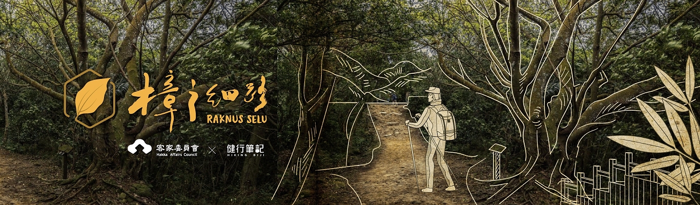
Passing through the mountainous areas between Taoyuan’s Longtan District and Taichung’s Dongshi District, Raknus Selu Trail (樟之細路) is one of the national greenways in Taiwan, running parallel to the Provincial Highway 3. Ranking in fame with Tamsui-Kavalan Trails (淡蘭古道) and Mountain to Sea National Greenway (山海圳綠道), Raknus Selu is a trail that connects Taiwanese ordinary people’s life.
The name of Raknus Selu Trail is a mixture of minority languages. Raknus is the term used by the Saisiyat and Atayal tribes to refer to “camphor tree,” and “Selu” means “small path” in the Hakka language. This trail is rich in historical significance owing to the camphor industry that for a time closely connected various ethnic groups and created an entanglement of interests amongst them. The name of the greenway adopts an indigenous-Hakka combination, telling the history of ethnic conflicts in the early years and raising hopes for peaceful coexistence in the future.
Raknus Selu Trail has a total length of 380 kilometers. Apart from pathways and mountain tracks, Raknus Selu Trail also includes developed industrial roads and highways. Having rich and natural ecology and diverse cultural landscape, Raknus Selu can be regarded as an important route in the west of Taiwan.
Since the Ming Dynasty (1368-1644), many Han people, including Hoklo and Hakka, immigrated to Taiwan from the coastal provinces of China to build an agricultural society in the plains and gradually developed into the inner mountain area as the population grew in northern Taiwan.
“The inner mountain area” refers to the hilly area of northwestern Taiwan. It was the place where lived the Saisiyat and Atayal peoples, who relied on mountain and forest resources for generations.
In the process of reclamation, Han people and indigenous peoples inevitably came into conflicts. Although the ethnic estrangement and cultural differences led to frictions, they also resulted in mutual exchange and deep understanding, revitalizing the cultural landscape of the regions along Raknus Selu Trail.
Over the past few decades, with the opening of the Provincial Highway 3 and the national industrial transformation, villages in the inner mountain area have suffered the flow of young people away to the cities, and traditional lifestyles have faced unprecedented challenges. In the early years, the hunting trails of the indigenous people, the tunnels used by the Han people for reclamation in inner mountains, and the necessary routes for business travels all became indiscernible in the deep forests, and few people were interested in them.
With concerted efforts made by HAC, Taiwan Thousand Miles Trail Association (台灣千里步道協會), and Dnf Environmental Consultants Inc. (大凡工程顧問有限公司), these centuries-old historical trails re-connected with each other under the name of Raknus Selu Trail, becoming one of the national greenways. To increase the trail’s global visibility, a memorandum of understanding was signed in 2018 by Taiwan’s HAC and South Korea’s Jeju Olle Foundation for Ming Feng Trail, one of the paths on Raknus Selu Trail, and Jeju Olle Trail to become friendship trails.
For more information on Raknus Selu Trail, please visit the website https://hiking.biji.co/index.php?q=minisite&id=223.